PREHISTORIC  SETTLEMENT  PATTERNS  IN  BOHEMIA

THE  POTENTIAL  OF  NON - DESTRUCTIVE  METHODS  IN  ARCHAEOLOGY

 
SÍDELNÍ PROSTOR PRAVĚKÝCH ČECH
A PROJECT OF THE INSTITUTE OF ARCHAEOLOGY OF THE CZECH ACADEMY OF SCIENCES AND THE SOUTH BOHEMIAN MUSEUM


Project team: Martin Gojda , M. Kuna, R. Křivánek, N. Venclová, E. Neustupný, D. Dreslerová et al. (IoA Prague)

Collaborator: Petr Zavřel (South Bohemian Museum, České Budějovice)

Duration: 1997 - 2002


The project, unique in Central Europe, offers a complex approach to the study of prehistoric settlement space, to the analysis of the social dimensions of the cultural landscape, and to the reconstruction of landscape form from the development of agriculture until the beginning of the Middle Ages.


Project charakteristic

  1. The extensive application of non-destructive methods

  2.  
  3. A preference for settlement space (as opposed to settlement points - sites)

  4.  
  5. The use of specialist equipment and modern technology

  6.  
  7. Complexity in the use of heuristic methods

  8.  
  9. Participation in the university teaching of archaeology by members of the project team

Primary project aim

To discern the basic factors of structure and change in prehistoric settlement with the aid of a sample of archaeological sources structured according to various scales.


Basic problem areas which the project seeks to resolve:

The relationship of prehistoric communities to the natural environment, and the reconstruction of the shape of the cultural landscape.
The structure of the settlement network and its diachronic changes with regard to the demographics and mobility of prehistoric populations.
The identification of areas of activity (residential, production, ritual) and their elaboration within the framework provided by settlement area theory.
Critical evaluation of basic sources with regard to the individuality of particular regions and periods.


    HEURISTICS
Odrážka

Data obtained from fieldwork.

Odrážka

Archive and bibliographic research, museum collections, preparation of basic maps.

AERIAL ARCHAEOLOGY

Aerial reconnaissance.

Aerial documentation of historic landscapes.

Training flights for students and professional archaeologists.

Overflights.

SURFACE SURVEY

Ploughwalking and artefact collection

Mapping.

GEOPHYSICAL SURVEY

FIELD EXCAVATIONS


BASIC & ANALYTICAL DATA PROCESSING IS CARRIED OUT WITH THE AID OF:

Odrážka Software that is integral to the technical equipment and instruments used (GPS, magnetometers, digital video, geophysics).
Odrážka Software designed for the processing of pictorial information (PhotoShop) and the transformation of oblique aerial photographs (AirPhoto).
Odrážka Specialist software products for processing spatial information (GIS).
 

Technical equipment & instrumentation

In addition to high-powered computers, among the most important pieces of project equipment are:

Odrážka The survey aircraft CESSNA 172 (reg. OK EKD)
Odrážka A pair of SM-4G (SCINTREX) caesium magnetometers
Odrážka A SONY DCR-VX9000E professional digital video camera
          
Odrážka A GPS station for precise location finding, using the TRIMBLE PATHFINDER machine
Odrážka A TM-91 (SCINTREX) metal detector


Knowledge gained and results to date (partial)

 AEROARCHAEOLOGICAL SURVEY

  1. The discovery of an entirely new and in Czech archaeology virtually unknown type of feature - closed, linear formations round/oval in plan (from several dozen to hundreds of metres in diameter): Trpoměchy, Kly, Hrdly, and Chleby.

  2. The discovery of fortifications in exposed locations (hill-forts), e.g. at Přívory, Vepřek, Sazená, and Chedrbí.

  3. The identification of several extensive settlement areas or cumulations of dwellings and burial grounds (so-called "continual settlement areas"), e.g. at Hrdly, Jiřice, and Dušníky.

  4. The discovery of the plans of Neolithic "longhouses" and trapezoidal dwellings, e.g. at Hrdly, Lobkovice, Skupice,Lišany.

  5. The discovery of the plan of a round ditch with an entry corridor (Všestudy).


The cumulative effect of aerial survey is now beginning to be evaluated...

šipka

šipka

from the point of view of completing data sets from areas of interest

from the methodological point of view


SURFACE SURVEYS (AT LOCATIONS IDENTIFIED BY AERIAL RECONNAISSANCE)

Odrážka Indication of the basic possibilities for dating settlement components identified by aerial survey. The degree of certainty in the chronological assessment is dependent on a series of factors; not only the quantities of certain artefacts, but also their spatial distribution need to be considered.
Odrážka In some cases, the presence or absence of surface finds can be understood as a functional criterion (the absence of artefacts may reflect burials, but not residential areas).
Odrážka From the standpoint of settlement archaeology: the structure of a chronological period revealed by complex research at the site bears witness to long-term continuity.

GEOPHYSICAL MEASUREMENTS (RELATED TO AERIAL SURVEYS)

Odrážka The identification of those parts of features which, due to unsuitable (soil, vegetation) conditions are not visible on aerial photographs.
Odrážka The placing of the precise plans of the features into a co-ordinate system.


Analyses to date permit preliminary conclusions to be drawn regarding prehistoric settlement patterns in Bohemia

Continuity in the prehistoric cultural landscape has been established, particularly for production areas (functional, practical causes) and burial grounds (symbolic reasons). At Tišice, for example, and in the valley of the Vinoř stream, settlement area continuity has been established spanning changes in culture.
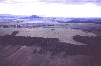
The Iron Age landscape was heavily, indeed almost entirely, forested (established from research in the Loděnice catchment area).
Other than links to components of the natural environment, there were strong bonds with preceding cultural landscapes. Settlement processes were also dependent on social factors. From this, it is perhaps possible to arrive at a means of predicting the occurrence of sites of archaeological interest.
In the framework of (extensive, continual) prehistoric settlement areas, the shifting of residential and burial components occurred, probably at the level of different archaeological cultures.
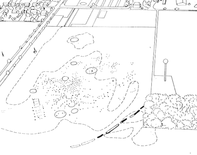
Odrážka The prehistoric Bohemian landscape contained far more closed, linear features - enclosures of differing shapes and sizes - than hitherto believed.
Odrážka The discovery of several new hill-forts, whose fortifications were identified purely thanks to crop marks, indicates that the fortification of exposed locations (particularly raised spurs isolated by one or two ditches) was more frequent than previously believed, on the basis of traces in relief 9ditches and embankments) or field excavations.


Key publications

Gojda, M. 2000: Archeologie krajiny- The Archaeology of Landscape. Vývoj archetypů kulturní krajiny. Prague, Academia (in print).
Neustupný, E. et al. 1998: Space in Prehistoric Bohemia. Prague, Institute of Archaeology.
Venclová, N. 2000: Výroba a sídla. Projekt Loděnice. Prague, Institute of Archaeology.


Phase 2 of the Prehistoric Settlement Patterns Project (2000 - 2002)

BASIC THEORETICAL QUESTIONS TO BE RESOLVED

Odrážka The dating, purpose and settlement context of prehistoric enclosures.
Odrážka The structure of manufacturing activities in the framework of settlement areas and larger spatial wholes.
Odrážka The relationship between residential and burial areas and other aspects of the internal structure of settlement areas. The mapping of selected landscape blocks and study of relationships between activity areas (The Říp, Tišice, Brandýs, and Bechyně areas). The dynamics of diachronic settlement processes along the middle Labe (Elbe), and the reconstruction of settlement patterns in particular periods.
Odrážka The spatial structure of residential areas (Roztoky).
Odrážka The methodical use of non-destructive means of data gathering to resolve questions of settlement history (comparing basic sources before and after the application of non-destructive techniques from a quantitative point of view) and the composition of such basic sources (from the qualitative standpoint - new, hitherto unknown types of features from cadastres in the areas of interest).


PLANNED PUBLICATIONS

Odrážka Textbook publication Nedestruktivní archeologie (Non-destructive archaeology) (Kuna, Gojda, Neustupný, Křivánek).
Odrážka Monograph publication Landscape and Settlement (Kuna, Dreslerová, Zvelebil, Voytek).
Odrážka Either as individual studies in professional journals or as a monograph Sídelní prostor pravěkých Čech. Krajina a sídla ve světle nedestruktivní archeologie (Prehistoric Settlement Patterns in Bohemia. Landscape and settlement in the light on non-destructive archaeology) (Gojda, Kuna, Křivánek).
Odrážka Studies or a monograph on research into prehistoric and historic long-distance trade. (Zavřel).
Odrážka Publication of field excavations conducted at particular sites, particularly Černouček (Brnič et al.), Uhy (Turek), Trpoměchy (Brnič et al.), and Kly (Foster).
Odrážka Processing of project themes on the Internet and on CD for presentation and study purposes.


obr. 1

Fig. 1. A characteristic example of the landscape of the broad accumulation basin of the Labe (Elbe) between Brandýs and Roudnice. The typical appearance of the landscape in the "early-settled lands" on the Pleistocene terraces of the Labe. Enlarge.

obr. 2

Fig. 2. The Říp region, and its dominant landmark.Enlarge.

obr. 3

Fig.3. The Říp region: the area of at the northern foot of Říp hill itself, clearly showing the prehistoric settlement in the cadastre of Rovné . Its existence was indicated by cropmarks.Enlarge.


Odrážka Back to AERIAL ARCHAEOLOGY AT THE IoA PRAGUE